An Giang - Boat Ride from Chau Doc to Phnom Penh (speed boat chau doc phnompenh)
Boat from Chau Doc to Phnom Penh. The main reason tourists visit Chau Doc is because it is a city where you can connect by boat or car to Cambodia. The most popular trip is the Speed Boat from Chau Doc.
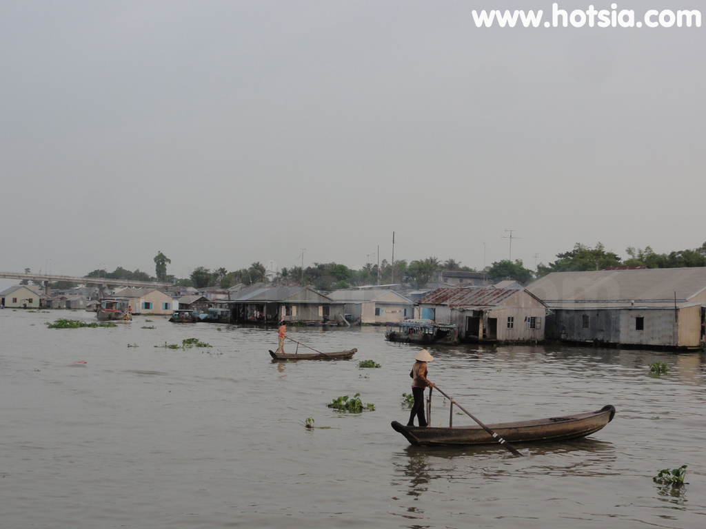
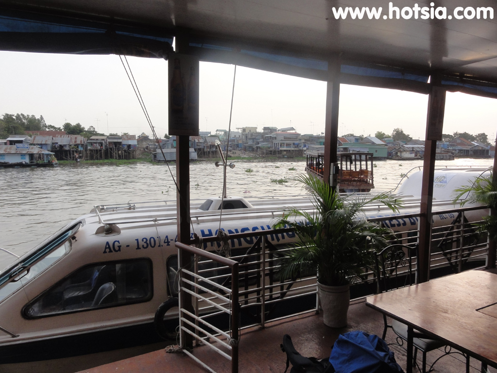
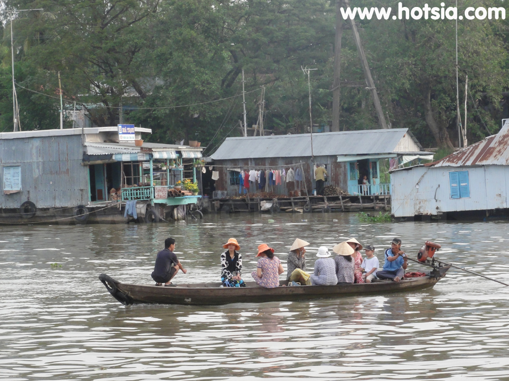
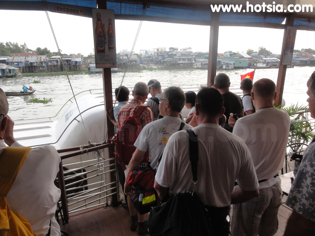
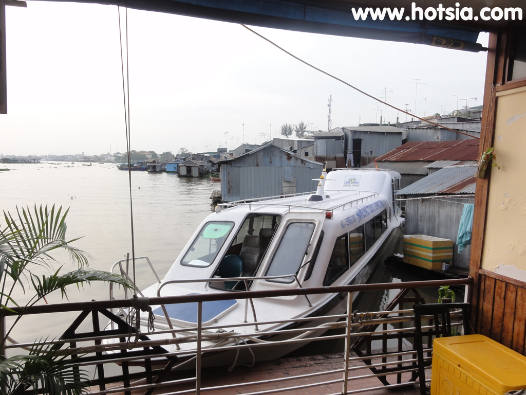
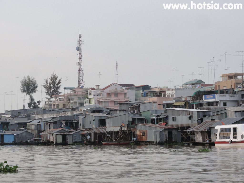
Traveling to Phnom Penh by boat along the Bassac River, a large branch of the Mekong River. Along the way, enjoy beautiful riverside views and see the riverside lifestyle with sand dredging boats and fishing boats. The journey takes half a day, with boats departing in the morning until noon. On this route, the boat passes a floating border checkpoint on the Vietnamese side where immigration checks are done by boat, while on the Cambodian side passengers must disembark.
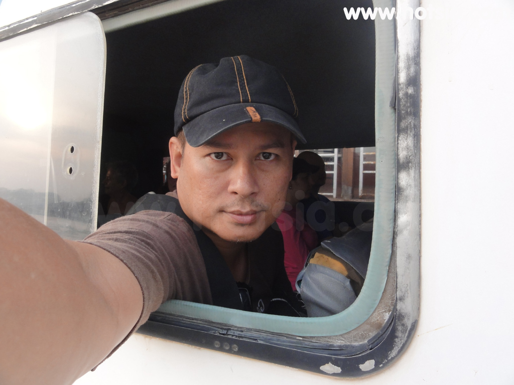
This floating border checkpoint is one of the few in the world. It was my first time crossing a border like this. The speed boat I took seats about 20 people. Several boats operate daily from different companies, as most tourists come to take the boat to Phnom Penh. For more information about the Speed Boat, visit Hang Chau speed boat website http://hangchautourist.com.vn. Mr.hotsia also traveled by this boat.
For immigration checks entering Vietnam and Cambodia, the Vinh Xung Kaam Damnor border checkpoint is used. It is a small checkpoint and the process is quick. After crossing into Cambodia, on the left bank of the river is Takeo province, and on the right bank is Kandal province. This river here is called the Mekong River. Shortly before reaching Phnom Penh, this is the last point of the Mekong River for the boat.
We must turn left into the river coming from Tonle Sap, called the Bassac River, not right going north toward Laos. Before reaching the palace, you will encounter another river called Tonle Sap River, which is connected to the Bassac River and flows through the royal palace. The speed boat arrives in Phnom Penh passing the palace and docks at the pier. The pier is not far from accommodation and restaurants, about a 300-meter walk along the riverbank to the market. A little further right along the alley is the accommodation zone, which is in the restaurant area and close to the palace and public park, convenient for walking.
Besides the speed boat from Chau Doc to Phnom Penh, there are also slow boats, combined bus and boat services available through tour companies in Chau Doc. For a clearer view, Mr.hotsia recommends clicking the GPS and zooming in or out to see the map as needed, showing river names and Mekong River connections.
The center point of the map you clicked shows the coordinates displayed in the image. Mr.hotsia January 2012. Regarding Mekong River information during the boat trip, I have compiled the following: 1. Tonle Sap River connects the Mekong River with Tonle Sap Lake. It is about 130 kilometers long and 500 meters wide. During the flood season, Mekong River water flows through this river into the lake.
2. Bassac River is the same river as Tonle Sap River, continuing from Tonle Sap River in front of Phnom Penh Royal Palace, flowing to Vietnam at Binh Di and then through Vietnam territory into the South China Sea. This river is narrower than Tonle Sap River, about 80 kilometers long, navigable year-round. Tonle Sap Lake is the largest freshwater lake in Southeast Asia and the largest natural reservoir in Cambodia.
Located in the central part of the country, surrounded by hills that are the source of various rivers flowing into the lake. In the dry season, the lake is about 150 kilometers long and 32 kilometers wide at its widest point, covering about 3,000 square kilometers. During the peak flood season from September to October, the lake expands to about three times its dry season size, approximately 10,000 square kilometers. Flooded areas extend to roads around the lake. Depth during the flood season is about
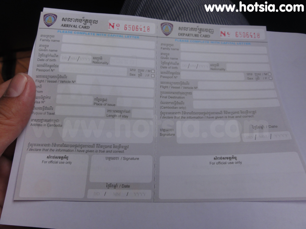
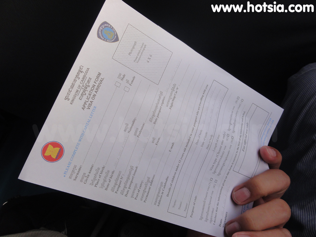
12-14 meters, and in the dry season, the shallowest water is about 0.8 to 2 meters. The shoreline area consists of sediment soil, with open land in elevated areas, and shrub and flooded forests along the lake edges. Appearance of the Speed Boat from Chau Doc to Phnom Penh, riverside atmosphere during the boat ride, views of Chau Doc city, Vietnamese ferry rowers. GPS coordinates (POI) Immigration officers distribute entry forms before crossing the border. The speed boat I took.
GPS coordinates: 10 54 35.183 N, 105 10 53.214 E Stop at Vietnamese immigration checkpoint at Chau Doc border. 10 55 30.276 N, 105 10 49.788 E Cambodian checkpoint in Takeo province. 11 34 32.424 N, 104 55 36.54 E Arrival in Phnom Penh. Atmosphere at Chau Doc. Boat ride from Chau Doc to Phnom Penh. 10 42 47.843 N, 105 7 15.57 E speed boat chau doc phnompenh. 10 42 50.237 N, 105 7 10.998 E Riverside houses in Chau Doc. 10 42 39.185 N, 105 7 19.29 E
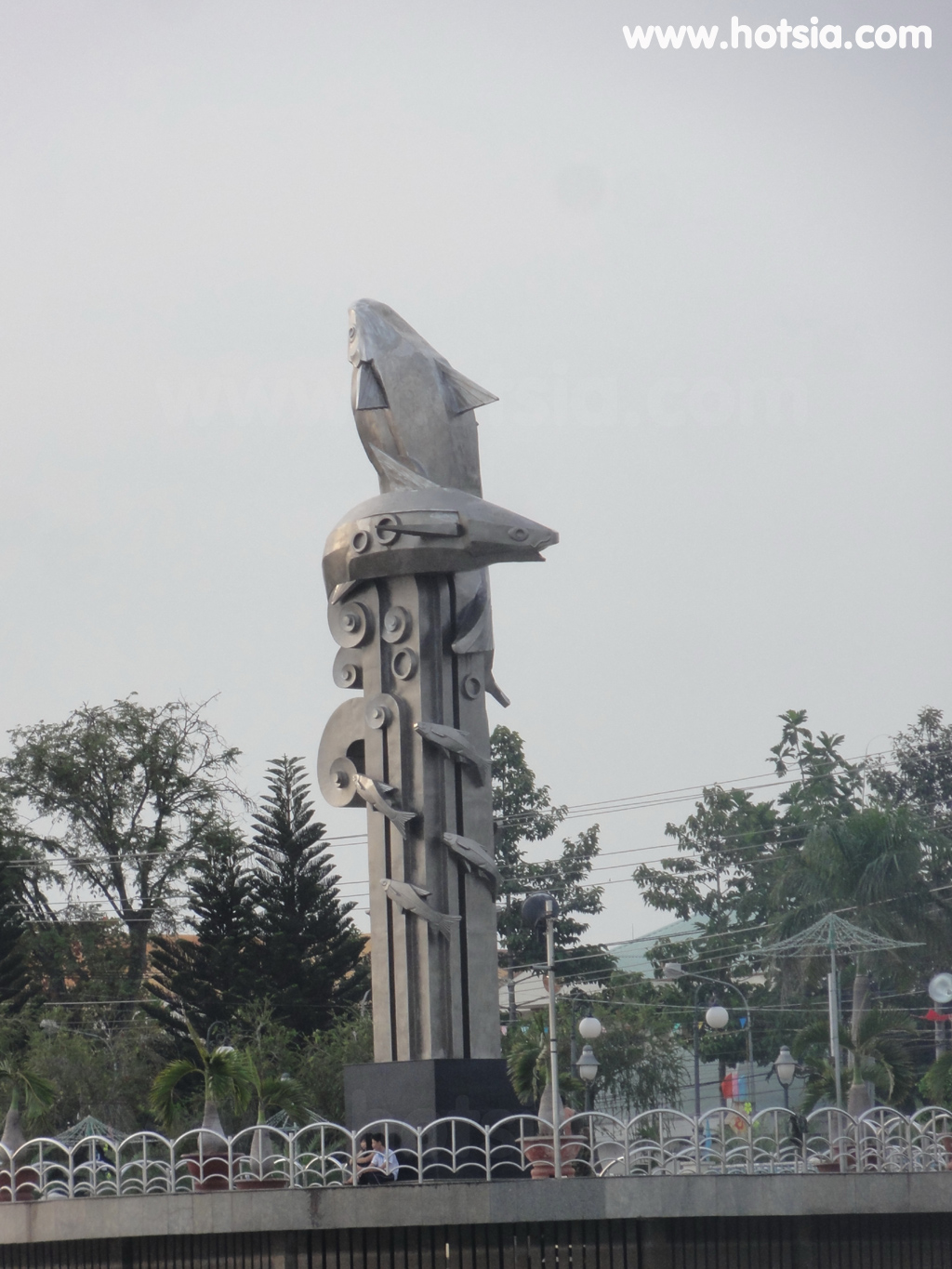
Bassac River fish monument. Cambodian entry form - no visa required for Thai nationals. Appearance of the speed boat to Phnom Penh. 10 52 19.692 N, 105 11 17.273 E Vietnamese people commuting. 10 52 41.796 N, 105 11 12.953 E 10 54 23.465 N, 105 10 56.262 E Vietnamese border checkpoint at Chau Doc. 10 54 35.075 N, 105 10 52.512 E Takeo province opposite Chau Doc. 10 55 30.39 N, 105 10 49.758 E Cambodian checkpoint in Takeo province.
/ Opposite Chau Doc. 11 33 26.939 N, 104 57 4.139 E Boat arrival in Cambodia. 11 33 33.03 N, 104 56 39.557 E Boat passing in front of Phnom Penh palace. Travel information about An Giang province, Chau Doc, and Long Xuyen city. An Giang province, Chau Doc city, local food in Chau Doc, Long Xuyen city, Speed Boat Chau Doc - Phnom Penh, Chau Doc - Takeo border checkpoint, Chau Doc bus station.