Travel Pakse Champasak Ban Nong Luang Pakxong Laos
Project gen by hotsia
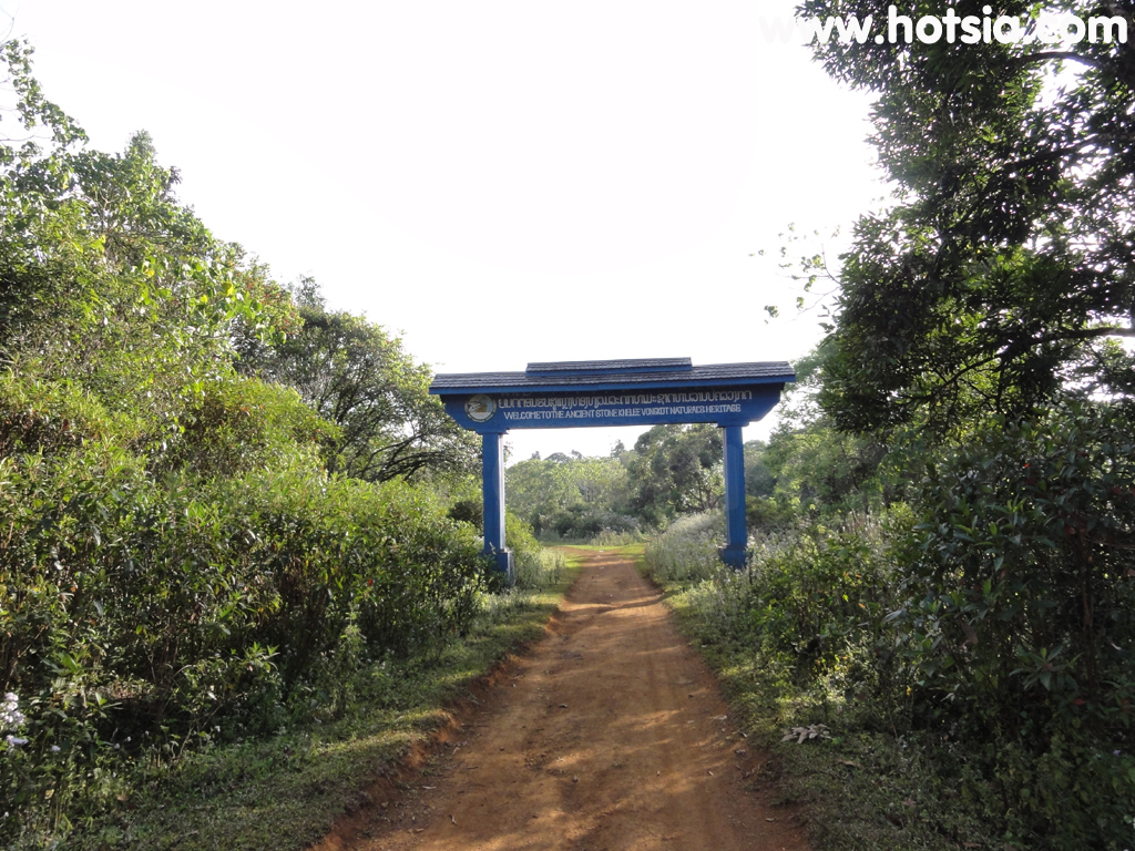
Ban Nong Luang Pakxong Laos http://www.hotsia.com > Travel Pakse Champasak > Ban Nong Luang Pakxong Laos Ban Nong Luang at Pakxong, Champasak Province, Laos is quite well known among Thai people because it has the famous Tad Tamued Waterfall, which was pioneered long ago by the popular backpacker website run by P'Kan. Ban Nong Luang is on the same highland as Pakxong, called the Bolaven Plateau. The distance between Ban Nong Luang and Pakxong, Champasak Province, is about 7 km.
The town below seen from the viewpoint at Ban Nong Luang is Utumphorn town, also in Champasak Province but at a lower elevation. On this trip, I chose to rent a motorcycle from Pakxong, ride to Ban Nong Luang, then walk to watch the sunset at the Ban Nong Luang viewpoint, and ride back to Pakxong at night. It offers a different atmosphere. The road turning to Ban Nong Luang is right at Pakxong, opposite the monument. The road is a dusty red dirt road, so if there are passing vehicles, you should prepare a mask to cover your nose.
Dust goggles are a must. Tad Suea and Tad Taket waterfalls here offer guided tours. There are homestays including meals at reasonable prices. You can contact the phone number below or come as a group and contact the backpacker service for convenience without changing vehicles yourself. If you prefer a more independent style without tours, you must rent a motorcycle from Pakse or Pakxong because there is no public transport at Ban Nong Luang. mr.Hotsia December 2010 recommends hotels in Pakxong.
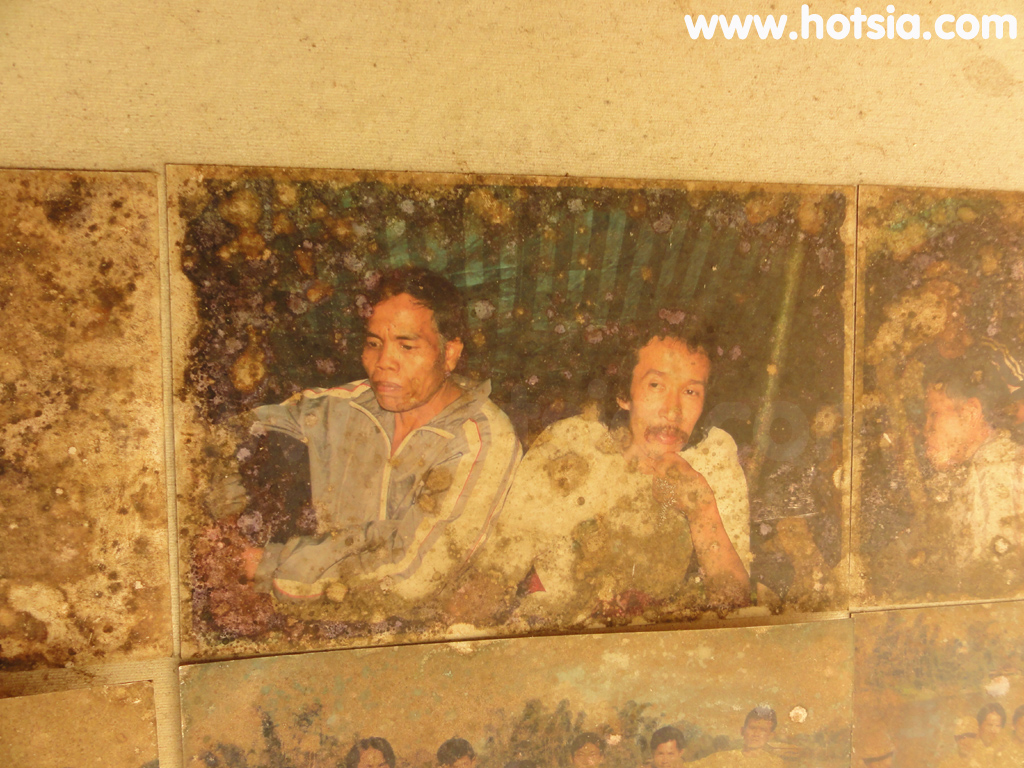
Travel information for Ban Nong Luang Pakxong, Ban Nong Luang viewpoint Pakxong 15°5'42.786"N, 106°12'42.39"E. See the location on the map. Found a photo of P'Kan the backpacker pinned on the wall at the guesthouse homestay in Ban Nong Luang, very impressive. 15°4'57.222"N, 106°12'28.451"E New friends met and went trekking to watch the sunset together. 15°4'41.861"N, 106°12'21.263"E Or the rocky heart, nature beautifully created. 15°4'34.956"N, 106°12'21.947"E
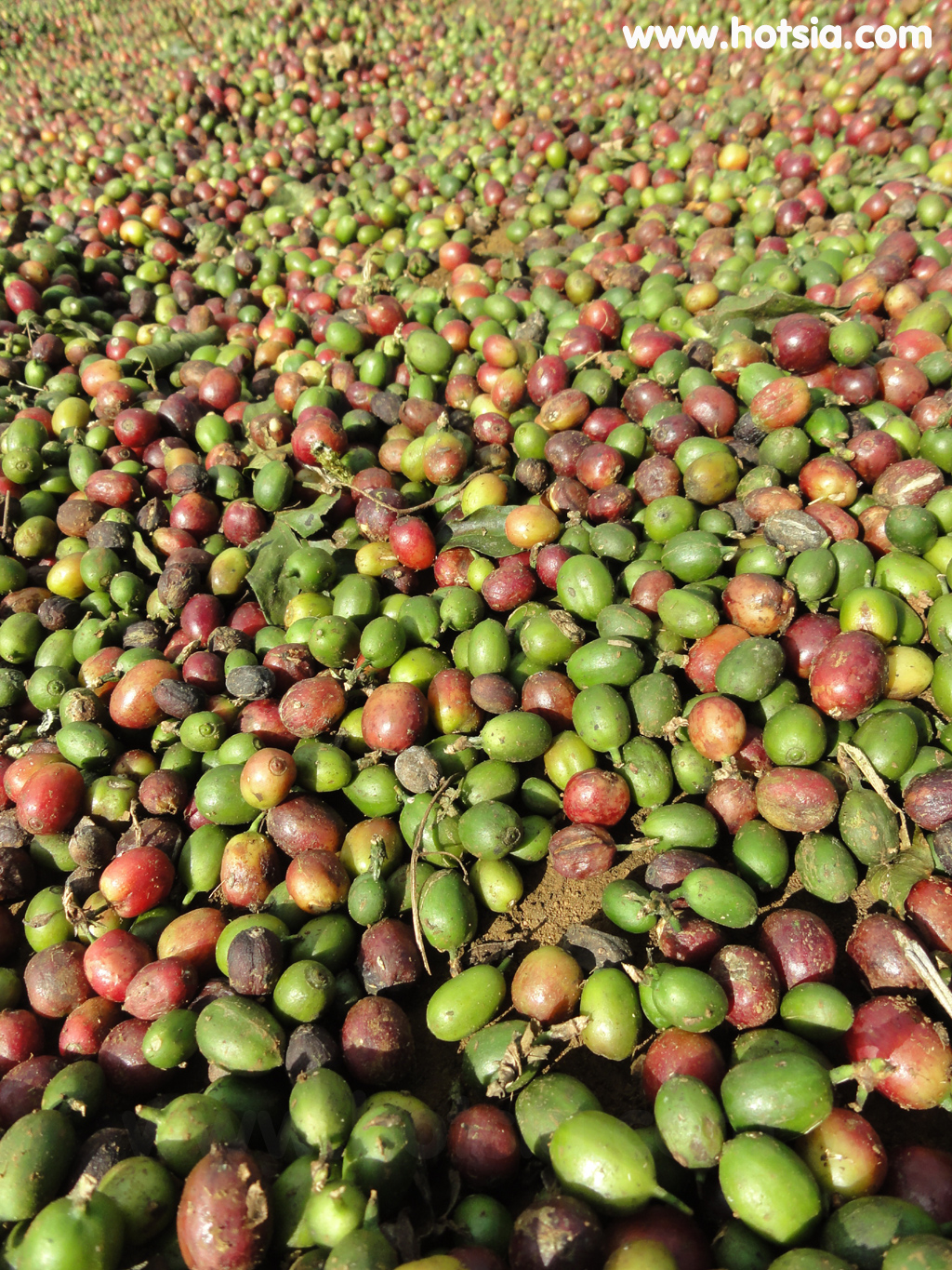
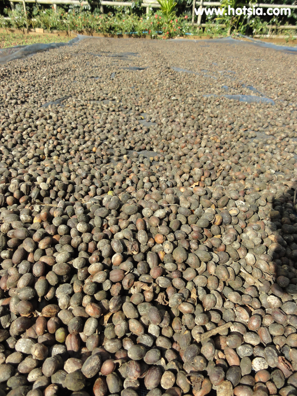
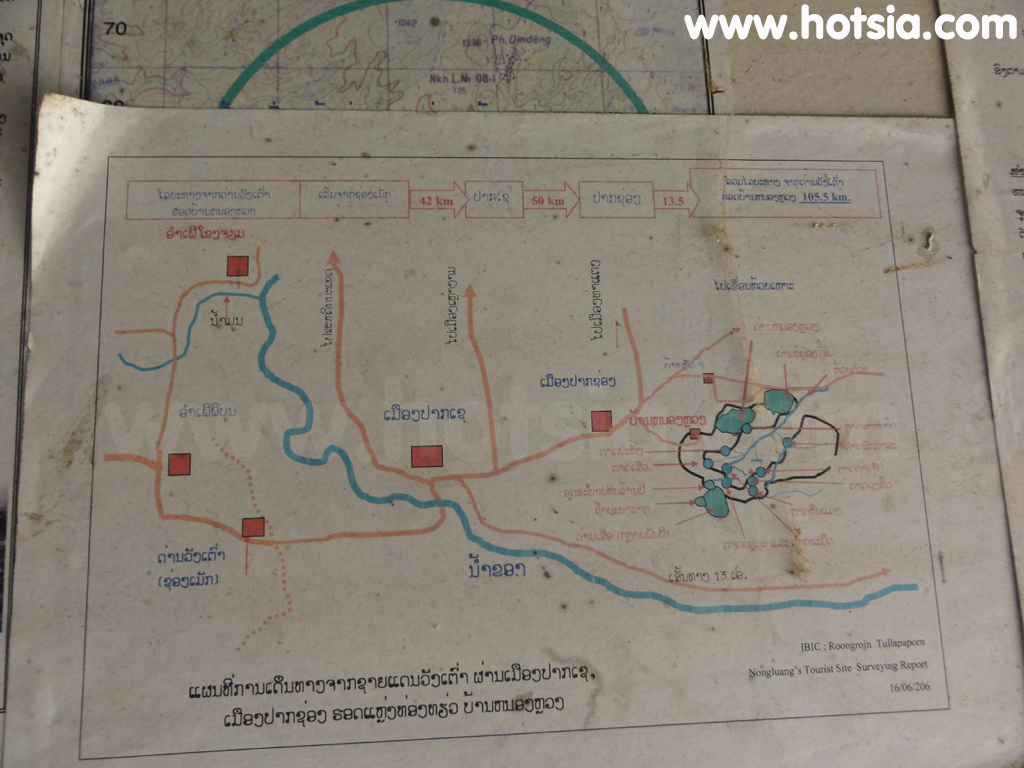
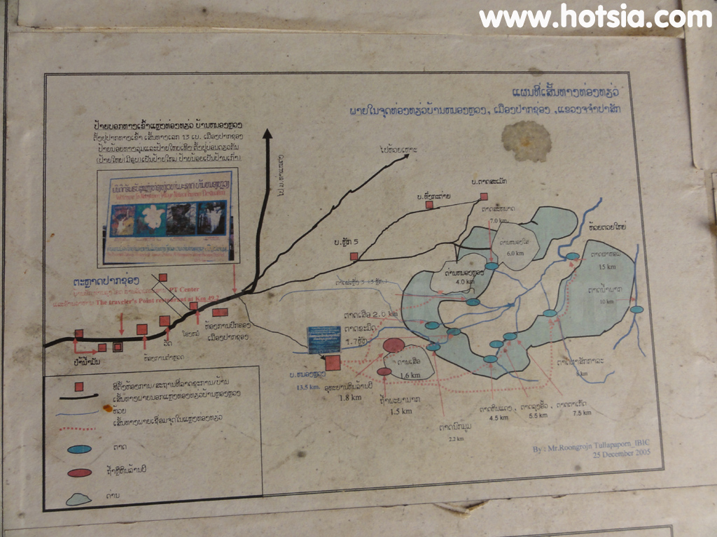
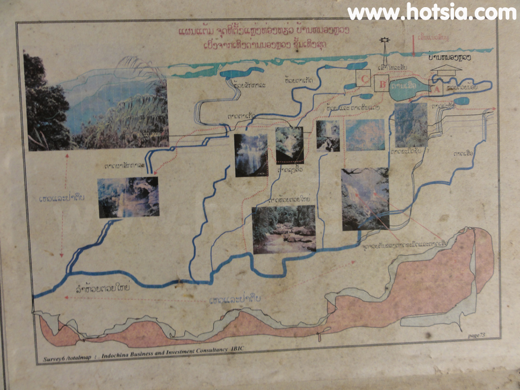
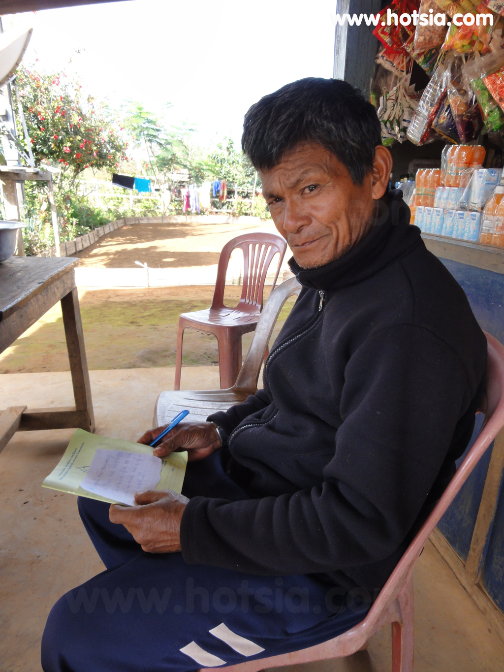
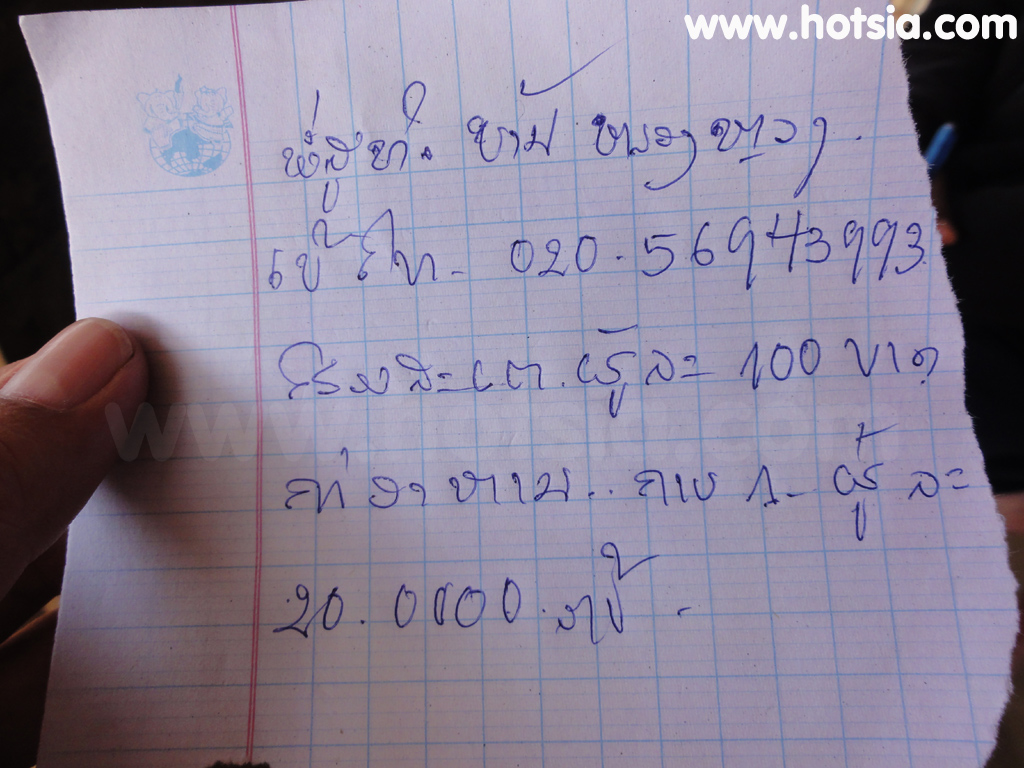
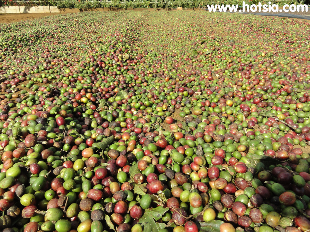
Viewpoint at Ban Nong Luang Pakxong 15°5'44.975"N, 106°12'43.121"E Coffee at Ban Nong Luang 15°5'44.969"N, 106°12'43.211"E Houses offering homestay services to see 15°5'44.939"N, 106°12'43.295"E 15°5'44.489"N, 106°12'42.749"E Trekking map of Ban Nong Luang Pakxong Laos, maps of waterfalls at Ban Nong Luang, map of Tad Takamued and Tad Suea waterfalls 15°5'44.802"N, 106°12'43.007"E The homestay owner 15°5'44.514"N, 106°12'42.917"E Address, phone number, prices
Various homestay locations at Ban Nong Luang 15°4'57.066"N, 106°12'28.709"E 15°4'38.088"N, 106°12'30.708"E 15°4'31.932"N, 106°12'30.965"E You must not cross the water like this, wrong way. Turn right at the fork. 15°4'41.874"N, 106°12'21.384"E 15°4'34.98"N, 106°12'21.557"E 15°4'34.992"N, 106°12'21.503"E 15°4'33.882"N, 106°12'20.135"E 15°4'33.815"N, 106°12'20.171"E Travel Pakxong, the coffee capital of Laos. Travel from Pakse to Pakxong. Discovered the 'eight-armed people' (strange).
Jin Dad Lao BBQ Pork Restaurant, Simali Guesthouse accommodation in Pakxong, Travel Ban Nong Luang