Travel Buriram: Phanom Rung Stone Castle
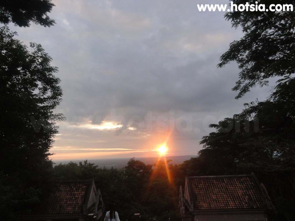
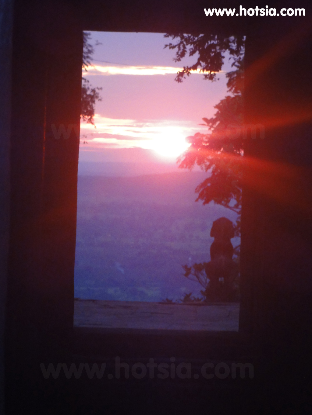
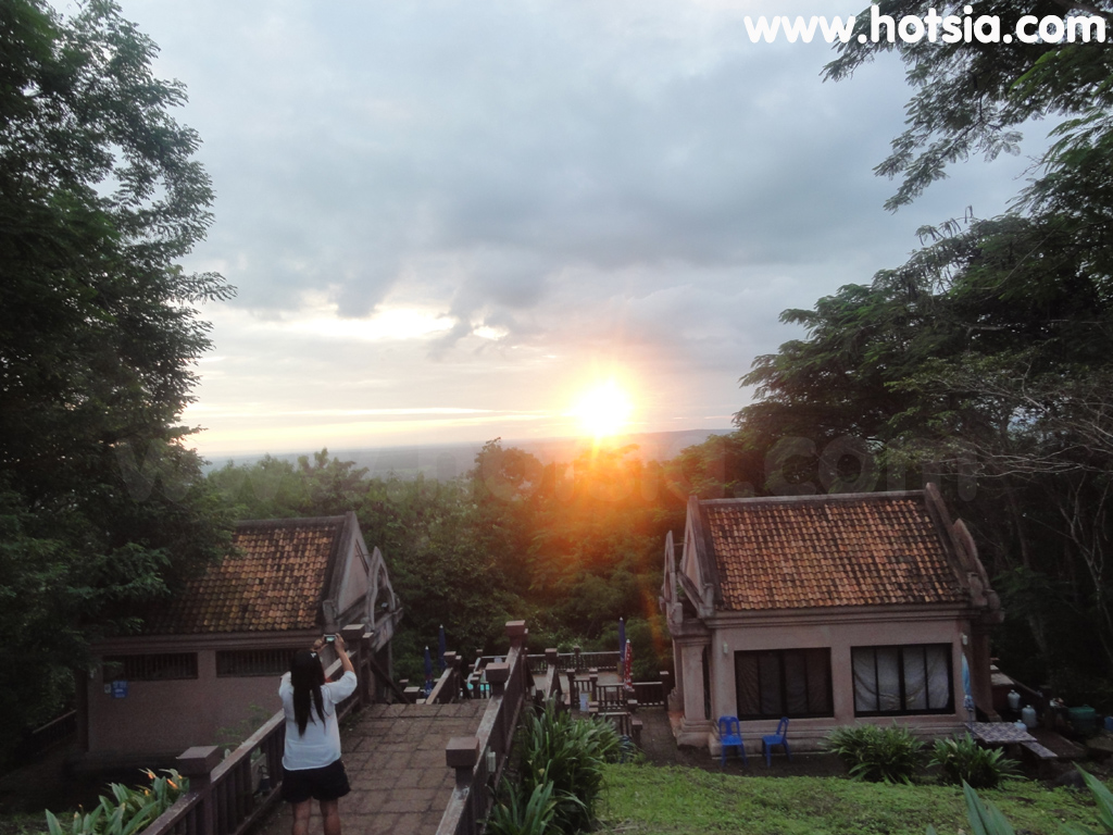
http://www.hotsia.com > เที่ยวบุรีรัมย์ > ปราสาทหินพนมรุ้ง ทริปท่องเที่ยวอื่นๆของผม บุรีรัมย์ ข้อมูลเที่ยวบุรีรัมย์ แนะนำโรงแรมในบุรีรัมย์ ผมมาเที่ยวปราสาทหินพนมรุ้งแบบไม่รู้มาก่อนว่าเป็นช่วงเวลาที่พระอาทิตย์จะขึ้นและตกดินตรงกัน 15 ช่องหน้าต่าง เป็นโชคดีของ Mr.hotsia ไปครับ ผมมาก่อนวันที่กำหนด 1 วัน แต่ก็ได้เห็นพระอาทิตย์ตกดินลูกกลมโตสีแดง ตรงช่องหน้าต่างทั้ง 15 บาน ช่างเป็นเรื่องอเมซิ่งไทยแลนด์จริงๆ
We must admire the ancient people who built this with meaning, which sometimes is still hard for us to understand. But it is not just for beauty and for future generations to visit. Normally, at this time, tourists would queue to see it. But recently, with floods in many provinces including Bangkok, there are almost no visitors here. It gives a different atmosphere. Phanom Rung Historical Park, or Phanom Rung Stone Castle, is located in Village No. 2 (Ban Don Nong Nae),
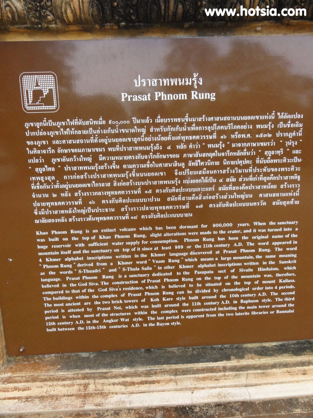
Ta Pek Subdistrict, Chaloem Phra Kiat District, about 77 kilometers south of Buriram city. It consists of important ancient sites located on the summit of an extinct volcano, about 200 meters above the plain (approximately 350 meters above sea level). The name Phanom Rung comes from the Khmer language, where "Vannam Rung" means "big mountain." Phanom Rung Stone Castle is a Hindu temple of the Shaivism sect, continuously restored and constructed over several periods since approximately the 15th Buddhist century.
Up to the 17th Buddhist century, and in the 18th Buddhist century, King Jayavarman VII of the Khmer Empire converted to Mahayana Buddhism. This temple was then adapted into a Buddhist religious site. Initially, Phanom Rung Stone Castle was built from pink sandstone, located on the summit of Phanom Rung mountain, 1,320 feet above sea level. The name Phanom Rung means "big mountain." It is believed to have been built between the 15th and 18th Buddhist centuries. Various inscriptions that scholars have read and translated suggest that
King Rajendravarman III, ruler of Angkor (B.E. 1487-1511), established a sanctuary dedicated to Lord Shiva at Phanom Rung. In the early period, it was probably not very large. Later, King Jayavarman V (B.E. 1511-1544) donated land and servants to the Phanom Rung sanctuary. In the 17th Buddhist century, Narendrasuri, a prince of the Mahidrapura dynasty ruling this region (ancestors of King Suryavarman II, the builder of Angkor Wat), constructed this castle and practiced asceticism as a yogi at Phanom Rung Stone Castle.
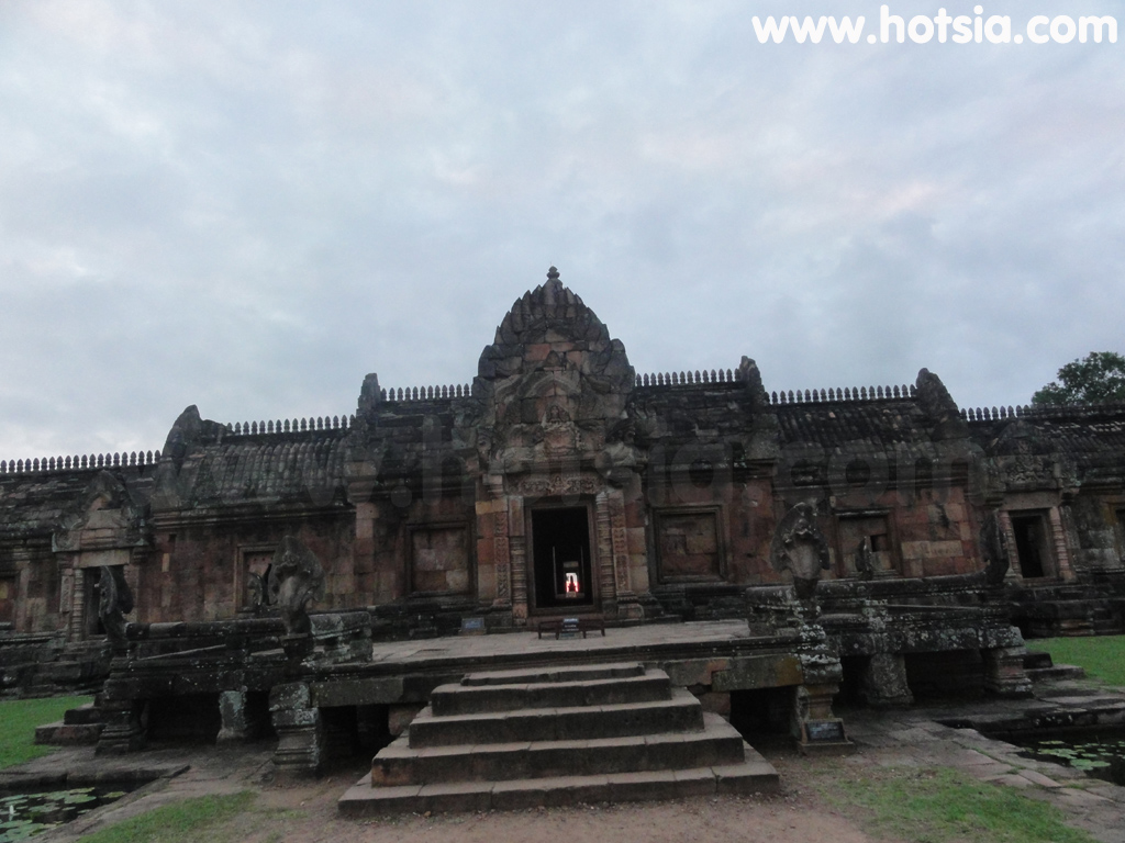
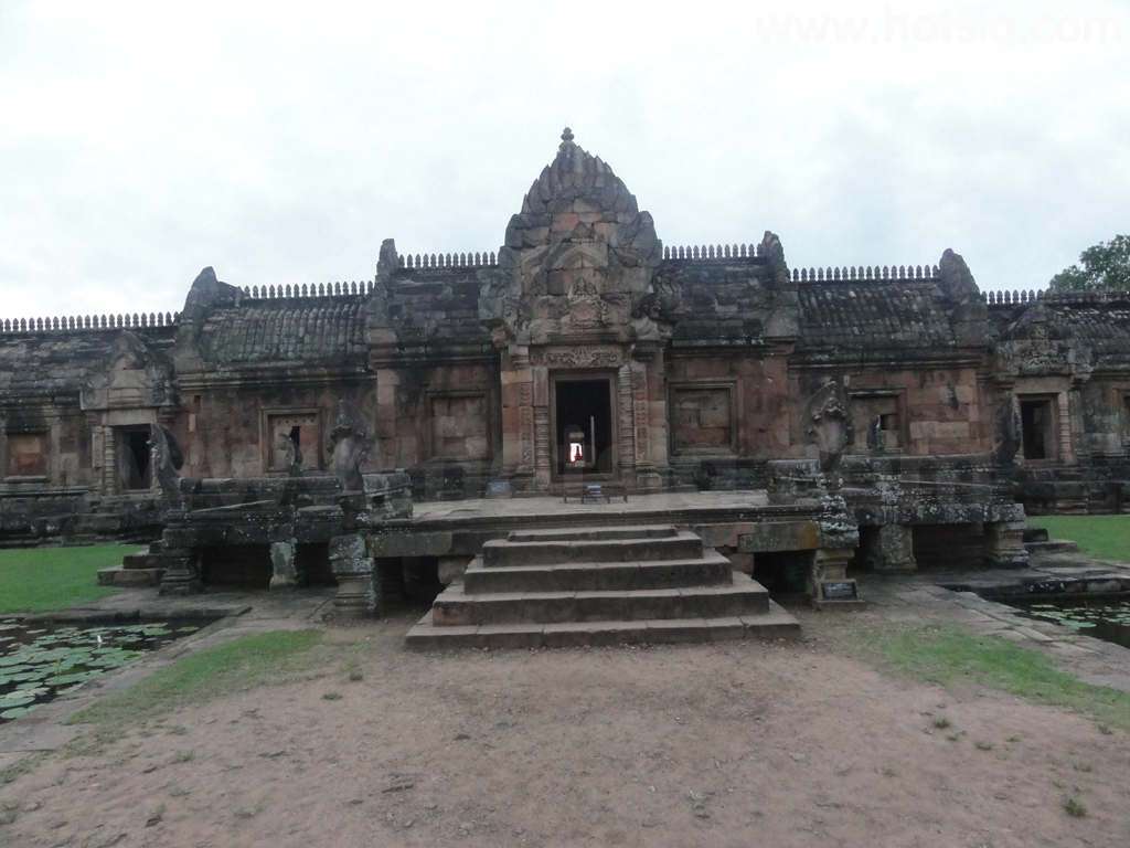
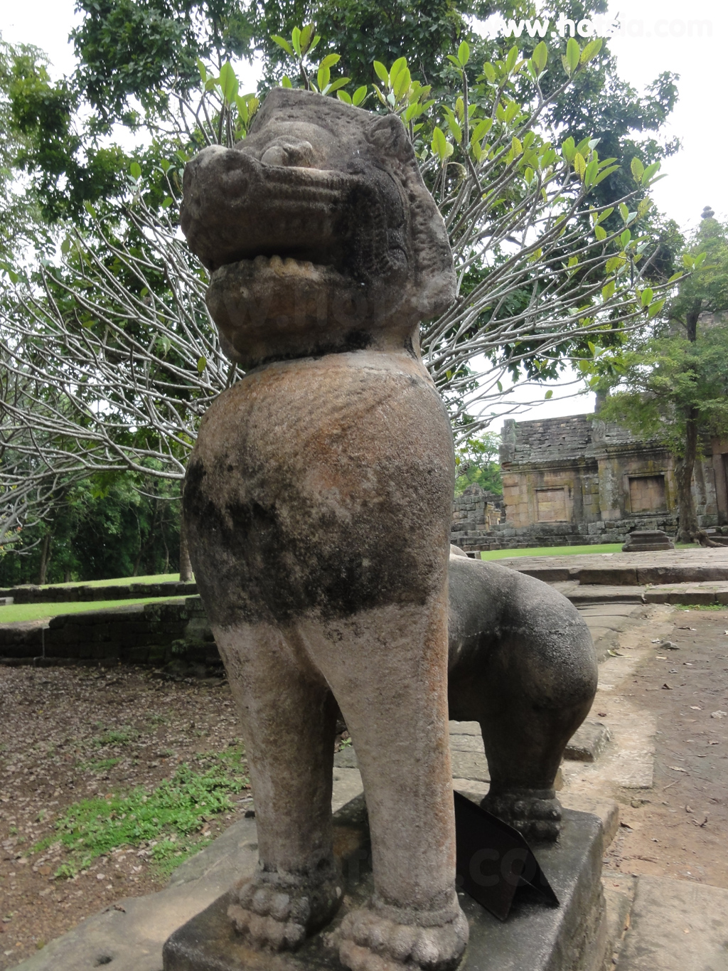
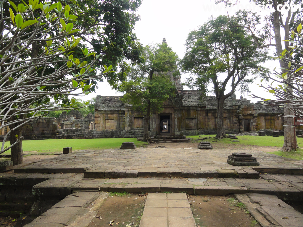
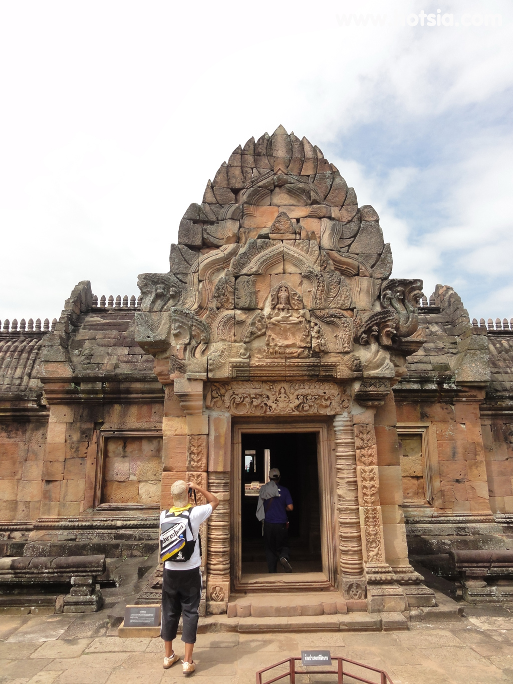
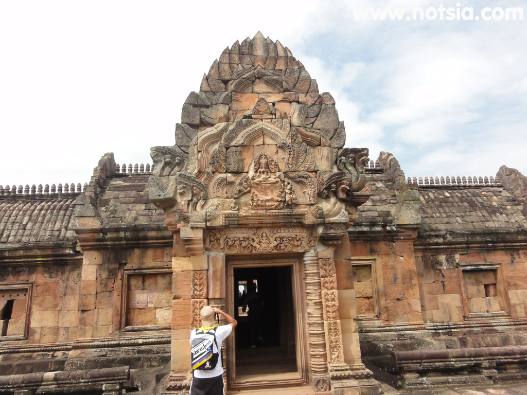
Phanom Rung Stone Castle was built for Hindu worship of the Shaivism sect, which venerates Lord Shiva as the supreme deity. Therefore, Phanom Rung mountain is considered equivalent to Mount Kailash, the abode of Lord Shiva. The structure and layout of Phanom Rung Castle were designed in a linear fashion, emphasizing importance toward the central point, which is the main sanctuary facing east.
To the right of the staircase leading up to the sanctuary is a building called the Phlab Phla. This building may be what is currently called the Phlab Phla Plueang Khruang, a resting place where the royal entourage prepares before entering to worship the gods or perform rituals within the sanctuary area. To travel to Phanom Rung Historical Park by private car, there are two routes from Buriram city as follows:
Travel via National Highway No. 218 (Buriram-Nang Rong) for about 50 kilometers, then turn left onto National Highway No. 24 (Sikhiu-Ubon Ratchathani) to Ban Tako village for about 14 kilometers. Then turn right onto Highway No. 2117, passing Ban Ta Pek, Chaloem Phra Kiat District for about 12 kilometers to reach Phanom Rung Historical Park. Alternatively, travel via National Highway No. 219 (Buriram-Prakhon Chai)
for about 44 kilometers to Prakhon Chai district. You will see a junction to Phanom Rung Historical Park, which is about 21 kilometers further via Highway No. 2075, then turn right onto Highway No. 2117 to reach the park. If traveling by bus from Buriram Bus Terminal, take the Buriram-Chanthaburi route and get off at Ban Tako village. Then take a local songthaew or a motorcycle taxi to Phanom Rung Historical Park.
Mr. Thani Samankit, Governor of Buriram, and officials inspected the damage. On May 19, 2008, unknown vandals destroyed guardian statues and animal mounts, including moving the lingam. The destruction involved breaking the arms of the deities first, then using the arms to smash the faces of other animal mounts. Independent historian Thepmontree Limpapayom stated that
using the guardian's wrist as a tool for destruction was likely because it was a hard material capable of damaging lions, nagas, or kinnaris. It is not a detail to emphasize that the guardian's hand was used to smash. Dusit Thummakorn, head of Phanom Rung Historical Park, noted that the damaged statues included only 4 naga heads out of 11; the rest were replicas over 20 years old. On May 26, the restoration team
from Phanom Rung Historical Park, together with the Fine Arts Department, began repairs starting with two lion heads on the west side of the castle. Materials used included stainless steel rods as anchors, synthetic rubber, artificial sandstone, powdered pigments, coconut husks, plaster, and epoxy adhesives. The Fine Arts Department stated that restoration would take one month. Video of Phanom Rung Stone Castle showing the sunset aligned with the 15
doorways at Phanom Rung Castle. GPS coordinates (POI): 14°31'55.019"N, 102°56'26.615"E; 14°31'55.332"N, 102°56'24.354"E; 14°31'54.252"N, 102°56'25.26"E. The sunset at Phanom Rung Stone Castle occurs only once a year and for four days when the sun sets exactly at 15°. GPS coordinates (POI): 14°31'54.954"N, 102°56'26.471"E; 14°31'55.044"N, 102°56'26.651"E.
GPS coordinates (POI): 14°31'55.26"N, 102°56'25.224"E. Sunset at Phanom Rung Stone Castle: 14°31'55.26"N, 102°56'21.953"E; 14°31'55.038"N, 102°56'22.842"E; 14°31'54.846"N, 102°56'23.148"E; 14°31'55.001"N, 102°56'26.538"E; 14°31'54.954"N, 102°56'26.471"E; 14°31'55.044"N, 102°56'26.651"E; 14°31'55.019"N, 102°56'26.615"E; 14°31'55.26"N, 102°56'25.224"E; 14°31'55.284"N, 102°56'24.426"E; 14°31'54.252"N, 102°56'24.732"E.