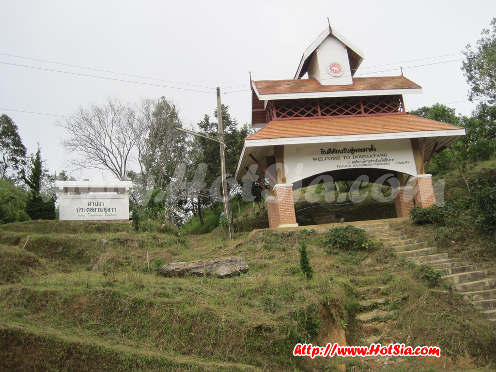
Chiang Rai Doi Pha Tang
Doi Pha Tang, Hill 102 103, Siam Gate, Khao Chong Khat, Yunnan Stone Garden http://www.hotsia.com > Chiang Rai > Doi Pha Tang. People often confuse Phu Chi Fa and Doi Pha Tang as being next to each other or even the same place!!! But actually, Phu Chi Fa and Doi Pha Tang are located apart. If coming from the north or Wiang Kaen, you will reach Doi Pha Tang first. Doi Pha Tang is on the Pha Mon mountain range in Wiang Kaen district, 160 kilometers from Chiang Rai and some distance from the district center.
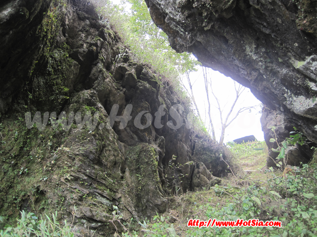
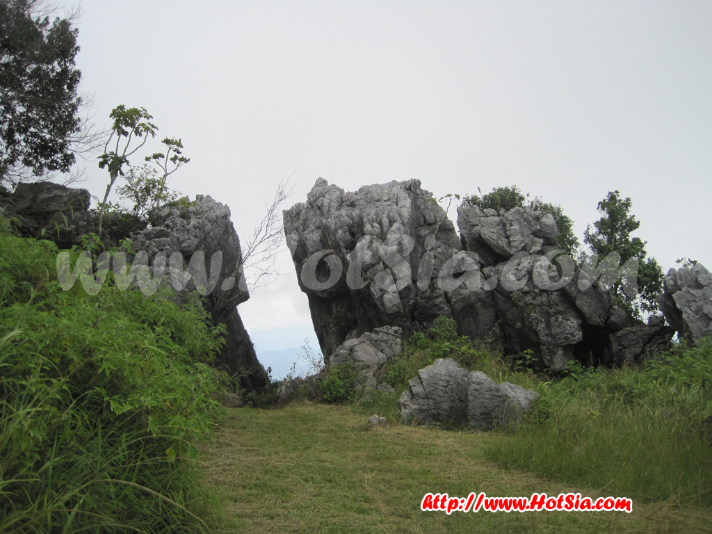
From Wiang Kaen along the Wiang Kaen-Pang Hat-Pha Tang route about 27 kilometers, Doi Pha Tang is a viewpoint overlooking both sides of the Mekong River, Thailand-Laos, and the sea of mist. On the mountain, there are villages of Chinese-Ho, Hmong, and Yao people. Especially the Chinese-Ho, who were once part of the 93rd Division and migrated to settle here. Nowadays, they engage in agriculture, growing temperate crops such as plums, peaches, pears, and apples. At Doi Pha Tang, there is a real Siam Gate, which should more accurately be called the Gateway to the Mekong.
Because after passing the stone shaped like a gate, you can see the Mekong River. The area below the checkpoint is Laos. To clarify, the Mekong River flows out of Thailand at Kaeng Pha Dai in Wiang Kaen district, Chiang Rai province, then flows along the border passing Pha Tang first, then Phu Chi Fa. We can see the Mekong River from both the summit of Phu Chi Fa and Pha Tang. The Mekong flows back into Thailand again at Kaeng Kud Koo in Chiang Khan, Loei province.
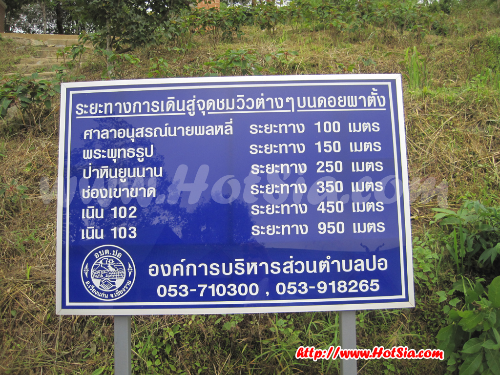
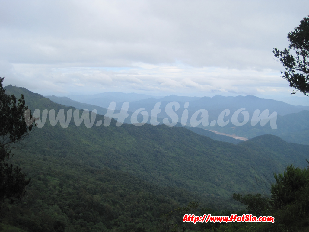
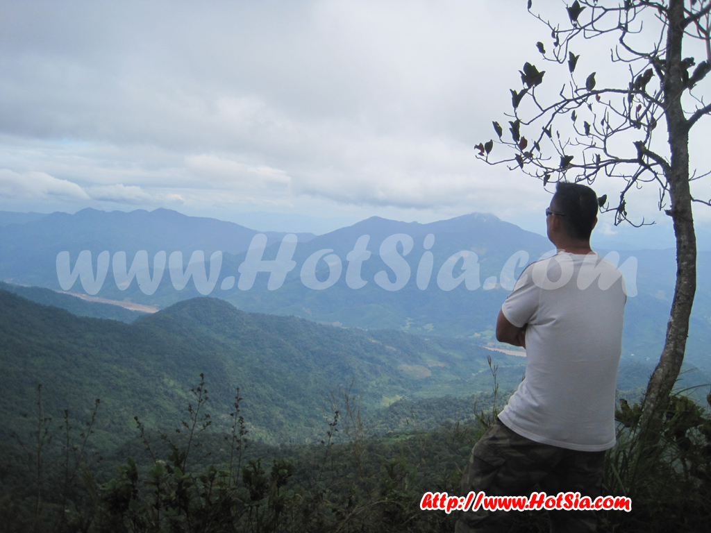
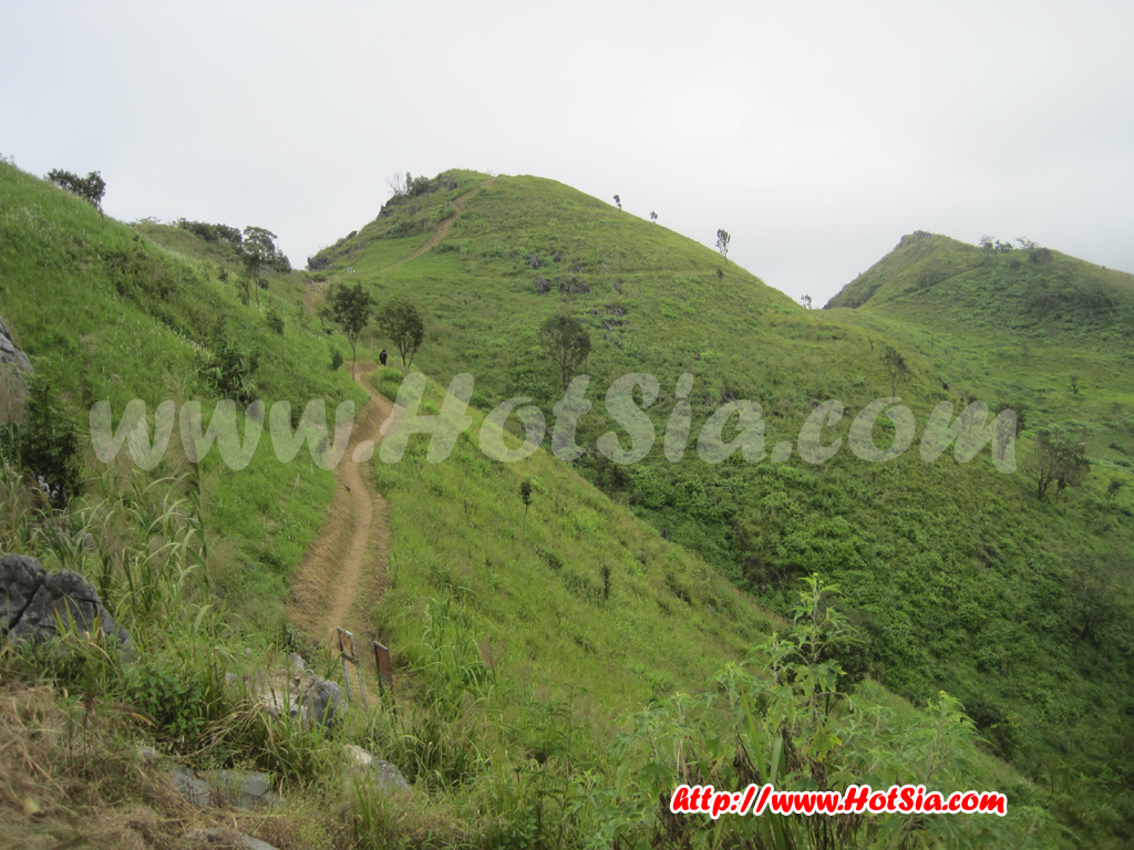
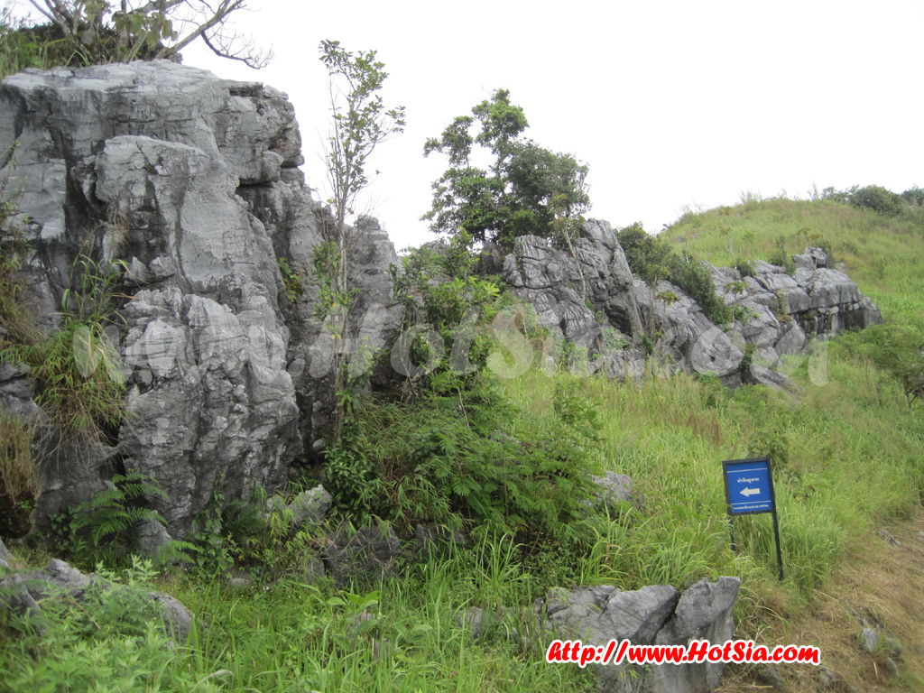
At Siam Gate, you can see the Mekong River flowing in Laos just within reach. The main tourist spot at Doi Pha Tang is Hill 102, which is a high point with a clear view of Laos and the sea of mist. When I visited Pha Tang, it was the end of the rainy season, with clouds drifting past the cliff. The view was stunning and truly cold. Visiting Doi Pha Tang is not difficult; you can see the view without getting tired from walking. Besides Hill 102, there are Yunnan stones, Chong Khao Khat, and a few other spots, but none are particularly notable.
For travel, use the route Chiang Rai - Wiang Chai - Phaya Mengrai - Ban Ta (Highways 1233, 1173, and 1152) 50 kilometers, Ban Ta - Ban Tha Charoen (Highway 1020) 45 kilometers, Ban Tha Charoen - Wiang Kaen - Pang Hat (Highway 1155) 17 kilometers, and Pang Hat - Doi Pha Tang another 15 kilometers. Then walk about 1 kilometer to reach viewpoint 103. Some parts of the route are steep. This area is under the care of the 3rd Army Region. At Doi Pha Tang, there are accommodations, camping sites, and restaurants. You can visit all year round. ............MrHotsia Oct 2010
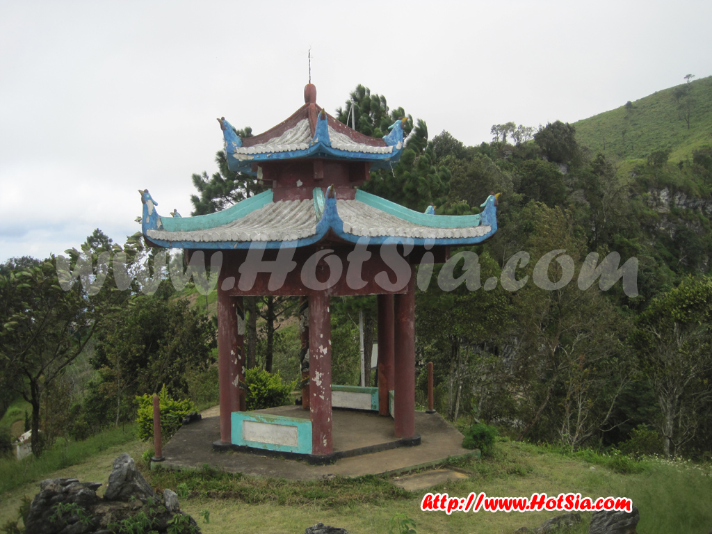
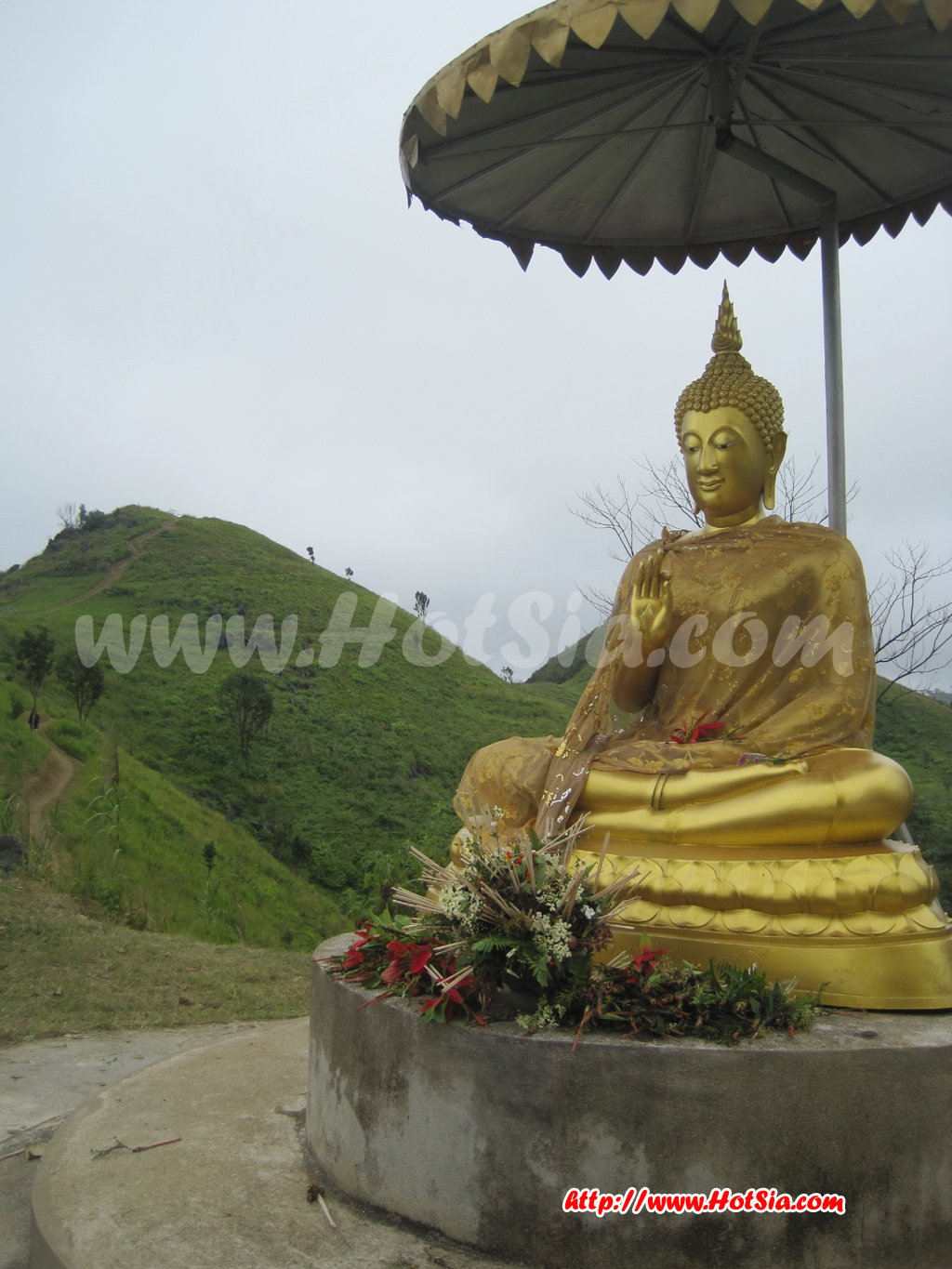
Chong Khao Khat at Doi Pha Tang. Beyond this pass is a cliff dropping into Laos. The first viewpoint shortly after climbing the mountain is Siam Gate; beyond the ridge is Laos. The farthest walk is to Hill 103 from Siam Gate at Doi Pha Tang. Viewpoints at Doi Pha Tang include the octagonal pavilion, the Buddha statue at Doi Pha Tang, and the path to Hills 102 and 103. All that you see is Bokeo province, Laos.
Mr.Hotsia from Hill 102. Trip by Mr.Hotsia to Phu Chi Fa - Pha Tang, Doi Pha Tang on the Thai-Laos border. Ban Boran Pha Tang restaurant, tasting roti to warm up at Phu Chi Fa. Cabbage road at Phu Chi Fa.