Traveling to Hpa-An, Kayin State on Your Own: Getting to Hpa-An, Kayin State
Getting to Hpa-An, Kayin State http://www.hotsia.com > Traveling to Hpa-An, Kayin State on Your Own > Getting to Hpa-An, Kayin State Information about traveling to Hpa-An, Myawaddy, Kayin State, Myanmar. Traveling to Hpa-An, Kayin State. Food in Kayin State. Hotels and guesthouses in Hpa-An. The floating pagoda Kyauk Kalap. Morning market in Hpa-An. Minibus from Kyaiktiyo to Hpa-An. Transport from Kyaiktiyo to Hpa-An. I recommend entering via the Mae Sot - Myawaddy border.
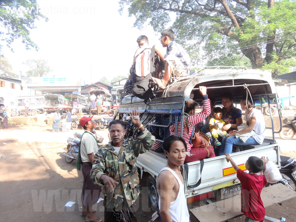
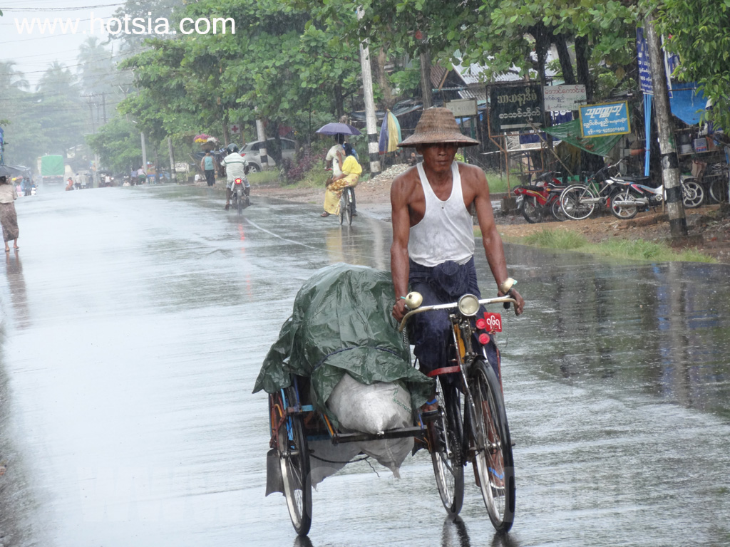
A four-hour local bus ride to Hpa-An. I flew from Mae Sot to Mawlamyine, traveled through several cities, then took a bus from Kyaiktiyo to Hpa-An. Alternatively, you can take a two-hour bus from Mawlamyine to Hpa-An. It is not recommended to take a boat upstream to Hpa-An as it takes 4-5 hours; downstream takes 2-3 hours. The Hpa-An bus station is located in the city center next to Soe Brothers Guest House, very convenient.
Traveling from the Mae Sot border opposite Myawaddy, Kayin State, Myanmar, you can take a bus from Myawaddy to Hpa-An. According to my latest information, buses to Hpa-An are available at the border crossing on the Myanmar side of Myawaddy. There are many buses parked there. I have not yet found a bus station inside Myawaddy town or near the market, but I expect one will open in the future. For my next trip, I will enter or exit via the Mae Sot-Myawaddy border.
During this trip to Myanmar, I saw several Thai tour groups entering via the Mae Sot border, bringing large motorcycles with them. Bringing special vehicles in groups into Myanmar requires prior documentation. Currently, the Mae Sot border is open, as are the Mae Sai and Ban Nam Phu Ron borders in Kanchanaburi. You can enter through one land border and exit through another, provided you have a Myanmar visa and passport. (See more information about Myanmar border crossings here.)
I read news that Thailand and Myanmar have agreed to cancel visa requirements for each other. This means that from now on, Thai people can travel to Myanmar with just a passport for up to 14 days, and Myanmar citizens can enter Thailand with only a passport. More Myanmar tourists are expected to visit Thailand. Mr.Hotsia, October 2013 (View of distant mountains near the community, delicious local food, fun with local Hpa-An people, boat from Hpa-An to Mawlamyine, boat from Hpa-An to Mawlamyine, local village, Salween River, Hpa-An 17°24'2.747"N, 97°4'41.903"E)
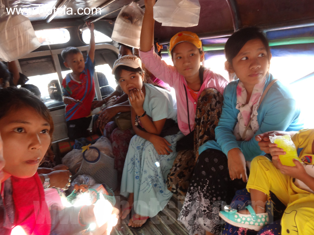
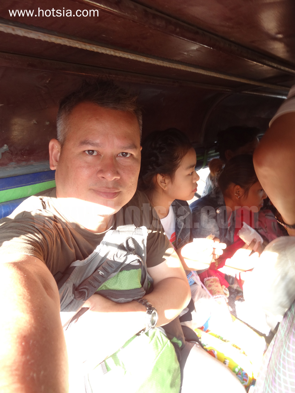
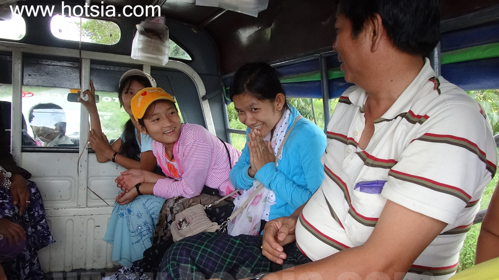
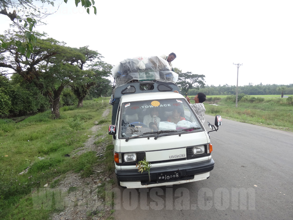
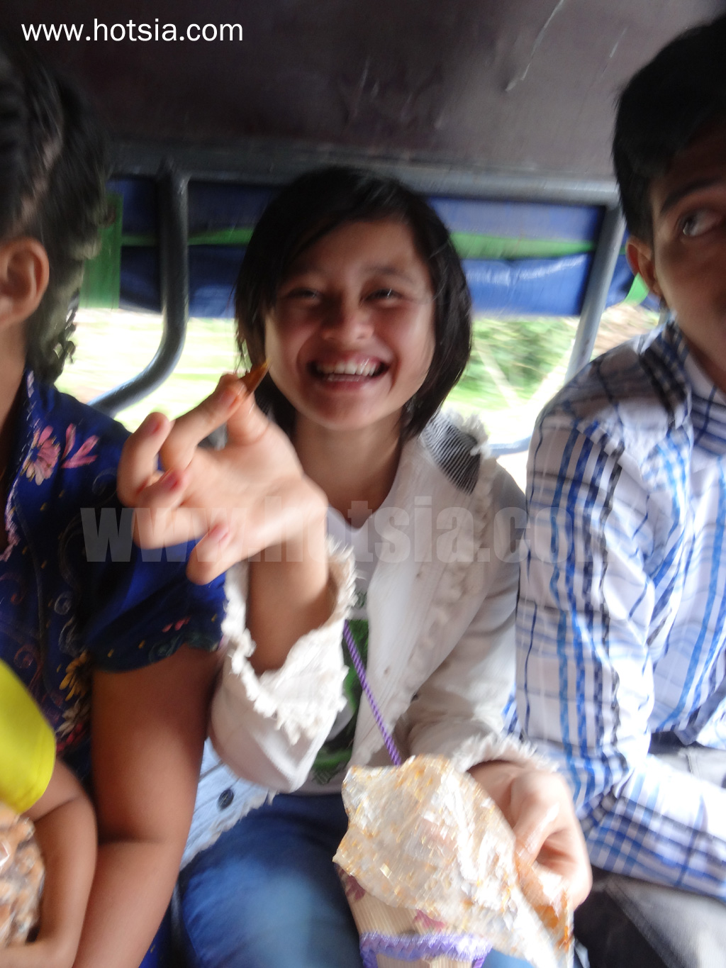
GPS coordinates (POI) from Kyaiktiyo below Sea Sar Hotel. Atmosphere of local buses; you must ride on the roof, but I prefer to sit inside. 17°23'59.033"N, 97°4'44.693"E 17°23'58.829"N, 97°4'44.591"E Atmosphere on buses in Myanmar 17°23'59.003"N, 97°4'44.297"E Practicing Burmese language. A vendor selling shrimp 16°55'12.677"N, 97°34'5.639"E Fish from the Salween River for sale 16°51'44.243"N, 97°36'45.306"E Boat ride from Hpa-An to Mawlamyine 16°50'32.975"N, 97°36'42.761"E
Cruising the Salween River from Hpa-An to Mawlamyine 16°43'0.167"N, 97°35'34.451"E Atmosphere during the boat ride on the Salween River from Hpa-An to Mawlamyine. I took off my shoes when boarding the boat. I use Wengen gear supported by an outdoor company. 16°37'57.623"N, 97°36'57.539"E Burmese woman wearing a traditional chest wrap bathing. Atmosphere during the boat ride from Hpa-An to Mawlamyine 16°37'55.812"N, 97°36'57.353"E 16°37'29.519"N, 97°36'49.961"E 16°36'31.397"N, 97°36'40.463"E 16°32'19.541"N, 97°36'49.109"E
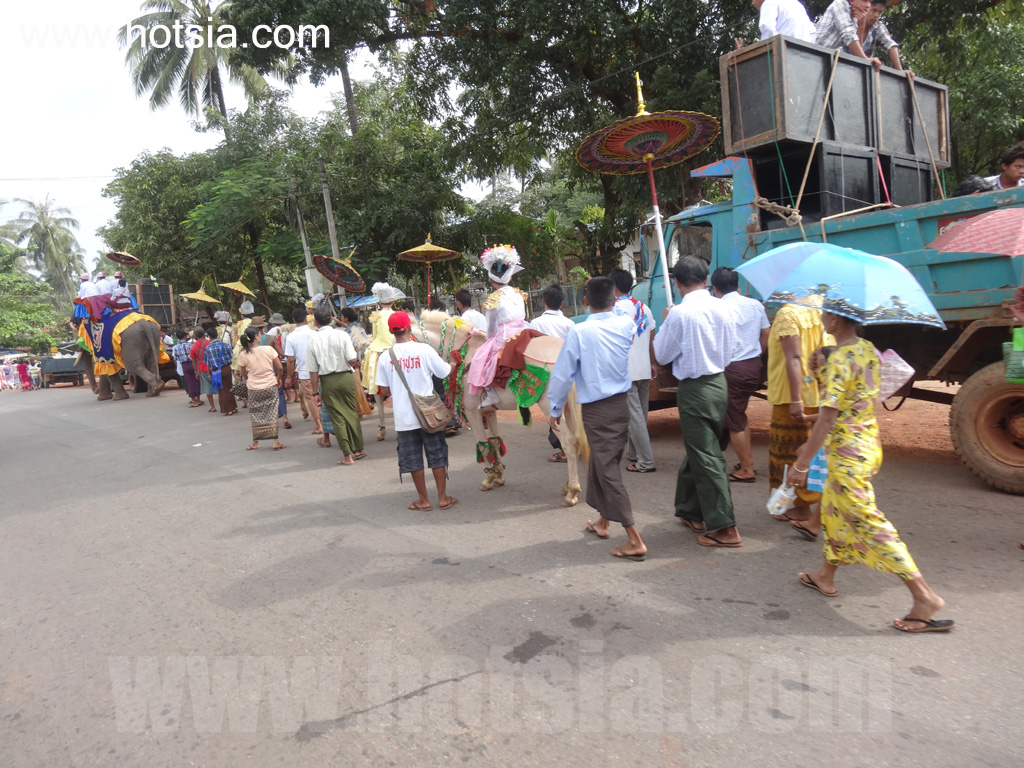
Riverside houses along the Salween River, Sea Sar Hotel, Kyaiktiyo. Ordination ceremony by the roadside in Mon State 17°0'29.531"N, 97°20'13.193"E This person speaks Thai; I met many who can speak it. How do you say 'delicious' in Burmese? Passengers along the way 16°55'33.317"N, 97°33'47.183"E Shrimp and fish from the Salween River? 16°52'59.363"N, 97°37'28.163"E 16°51'45.299"N, 97°36'45.504"E Trying the Salween River boat from Hpa-An to Mawlamyine. Atmosphere while trying the Salween River boat from Hpa-An to Mawlamyine 16°42'51.017"N, 97°35'32.789"E
Remove your shoes when boarding the boat 16°39'13.961"N, 97°36'33.461"E Burmese woman wearing a traditional chest wrap bathing in the Salween River